


PHILIP’S BEST-SELLING RANGE OF BRITISH AND EUROPEAN MAPS
‘THE CLEAREST AND MOST DETAILED MAPS OF EUROPE’ David Williams MBE, former CEO Gem Motoring Assist
The bestselling fold-out road map for navigating in Germany and the Netherlands has been updated for all travellers wanting to go places from Rotterdam to the Rhine. Whether driving through the most spectacular scenic routes the area has to offer along the Rhine or the Herengracht or planning your trip from Amsterdam to Berlin, this handy map has all you need.
– Super-clearmapping scale 1:1,110,000 (17.5 miles to 1 inch)
– Keydriving information: motorways (toll, pre-pay and free), mountain passes, railways, canals, road numbers (European and local), plus distances between towns
– Fully revised and up-to-date with the latest tourist and leisure information
– Scenic routes clearly highlighted
– Places of interest added: from castles, heritage sites, lakes and national parks to theme parks, places of worship and ancient monuments
– Double-sided maps – more for your money and easier to use
– Detailed city plans Amsterdam, Berlin, Cologne, Dusseldorf, Frankfurt, Hamburg, Munich and Stuttgart
In fact, everything you need for your trip to Germany and the Netherlands.


iPhone dock
Original price was: £399.00.£349.00Current price is: £349.00.
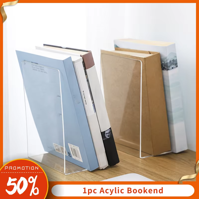
1Pc Transparent Acrylic Bookends Book Support Shelf Rack Bookends Book Shelf Desk Organizer Book Holder School Office Supplies
£1.67
Select options
This product has multiple variants. The options may be chosen on the product page
Augue adipiscing euismod
£199.00

Henectus tincidunt
£429.00


Reviews
There are no reviews yet.